Protect the Owyhee Canyonlands

A recent adventure through the Owyhee Canyonlands reignited a fervent commitment to secure its permanent protection as a national monument.
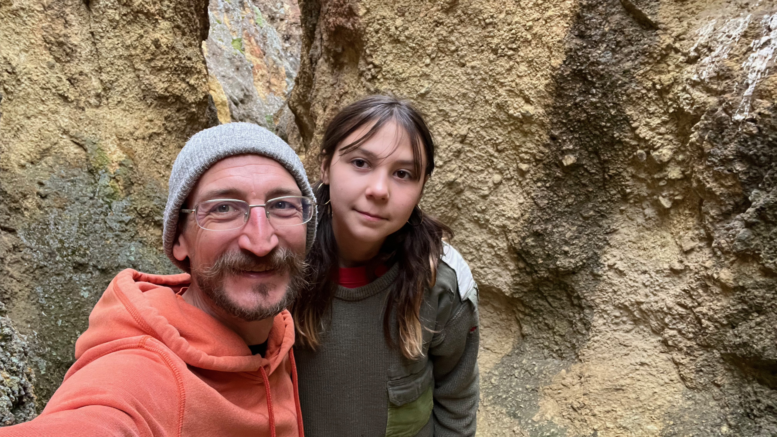
I recently had the opportunity to spend spring break exploring the Owyhee Canyonlands with my dad and my daughter. I’d been learning a lot about this area over the last few months and had extremely high expectations for the adventure — and it did not disappoint. Seeing the colorful canyons, seas of sagebrush and rambling Owyhee river in person helped cement my drive to win permanent protections for this Oregon treasure.
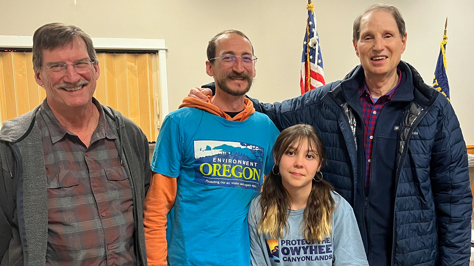
It’s a long — but beautiful — drive from Portland to Rome, which was where we decided to start our adventure, as many do, since there is a boat launch in Rome, often used as a starting point for rafting the Owyhee River. But we had a pit stop to make in Burns on our way, where we would meet up with my dad who lives in Illinois and attend Sen. Wyden’s Harney County Town Hall. There were a dozen or so people at the community center for this event and each of us had an opportunity to ask the Senator our questions. I was excited to have the forum to personally thank Sen. Wyden for all the work he has done with local constituencies to draft and introduce the Malheur CEO Act and to ask what more we can do to make sure that the Owyhee Canyonlands are permanently protected.
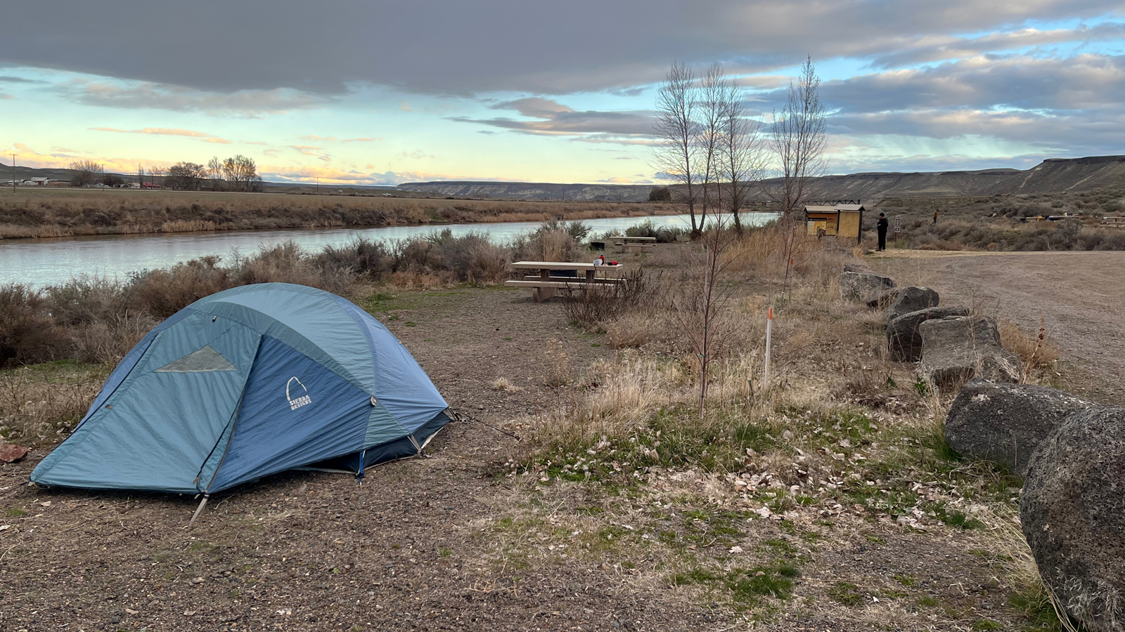
From Burns, we made our way to the Rome boat launch where we set up our tents, planned out our next day’s explorations and connected with folks that were car camping or preparing for their trips down the river. At this easily accessible boat launch, there are a handful of campsites right along the shore of the Owyhee River, pit toilets and a BLM ranger station. We soaked up the sunset and settled in for a good night’s rest.
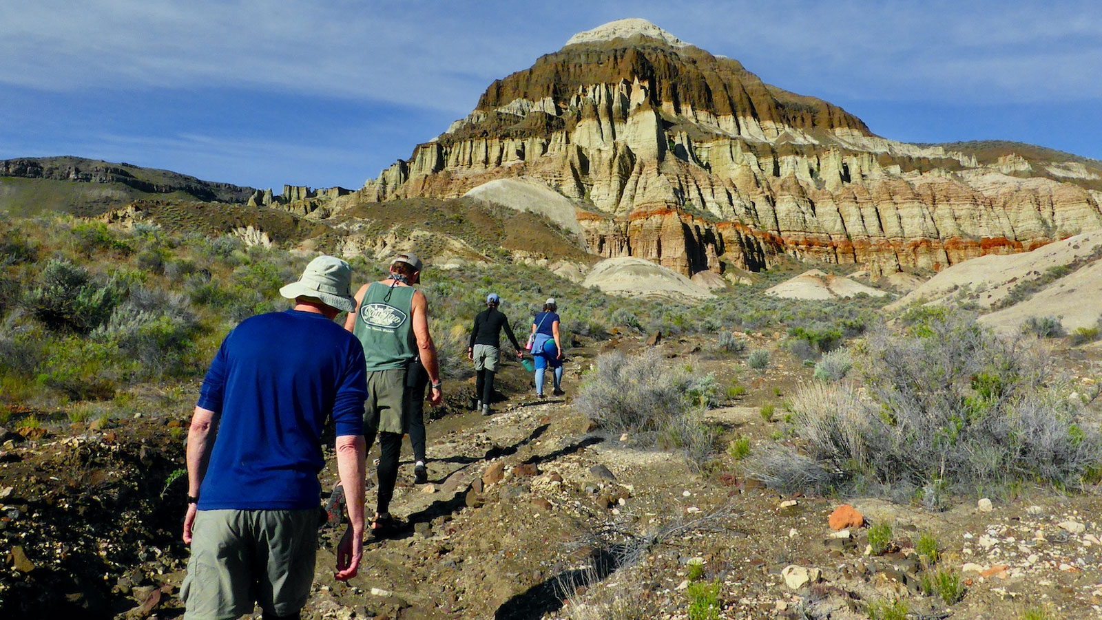
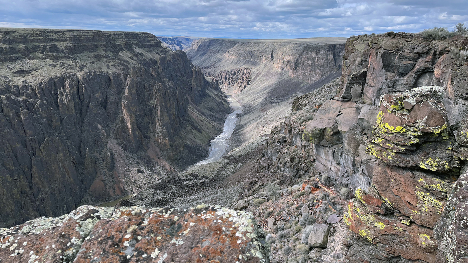
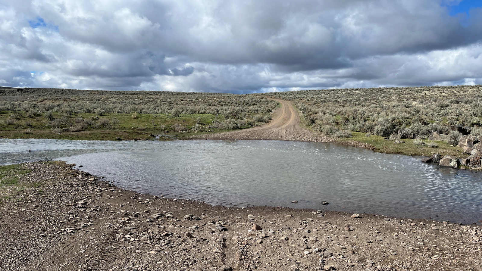
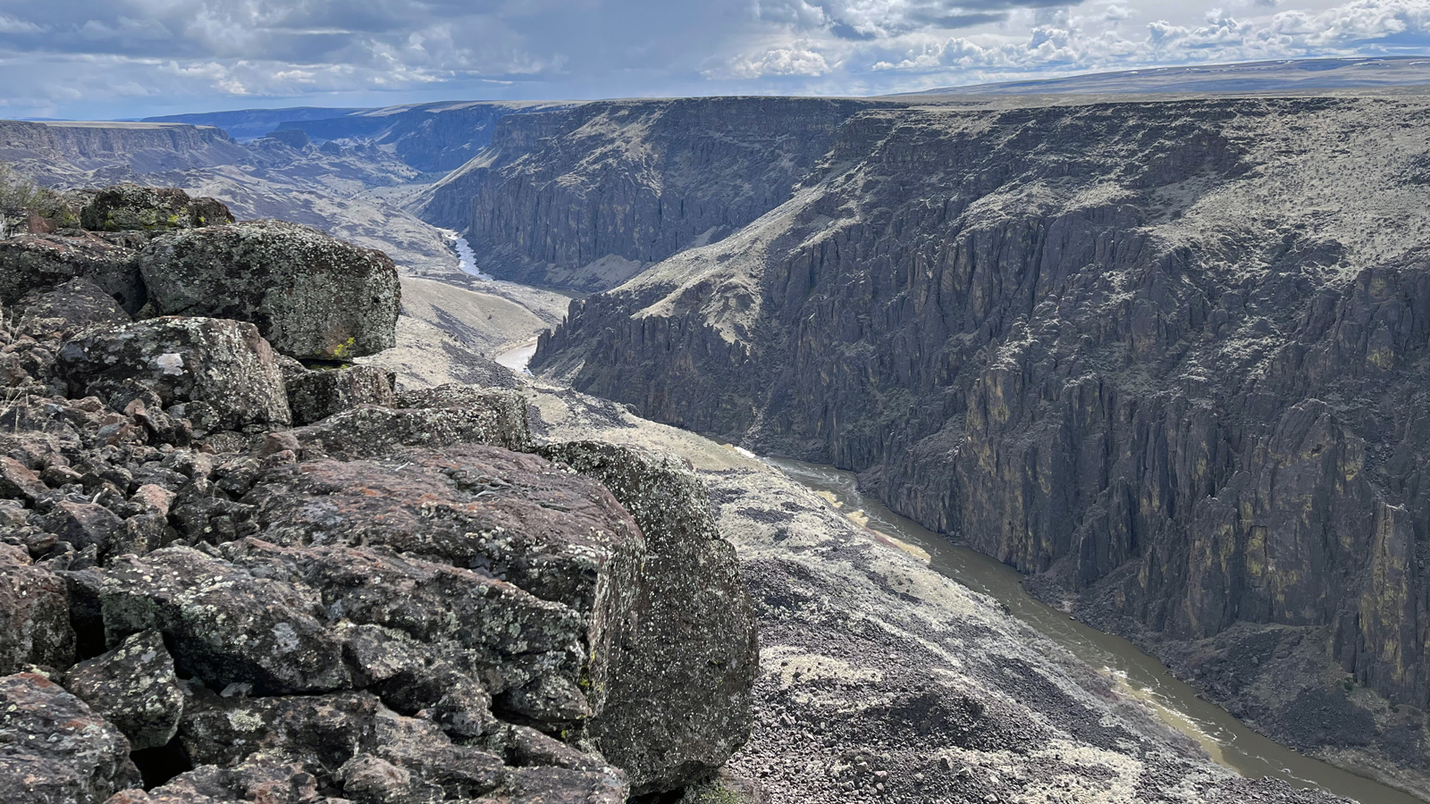
We started the next day by driving on Three Forks Road in an attempt to reach the Three Forks Recreation Area, but only made it to the Soldier creek crossing before deciding to ford the creek by foot. The hike along the dirt road through the rolling hills of sagebrush was a great opportunity to realize the vast remoteness of the region. There was only one truck that passed us during the long day of hiking. Eventually we reached a viewpoint of the canyon and had the chance to sit on the rim and take it all in before we turned back.
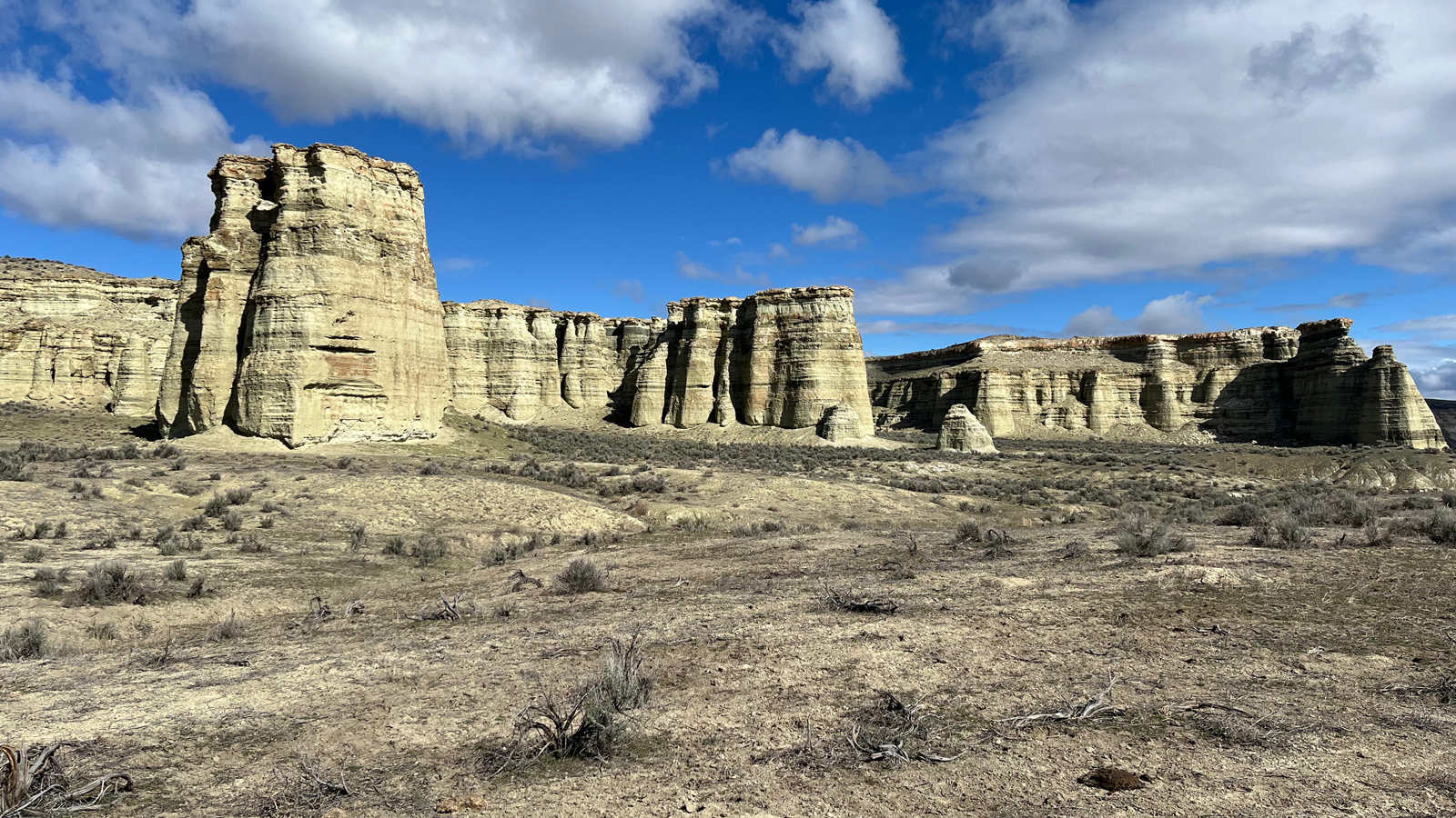
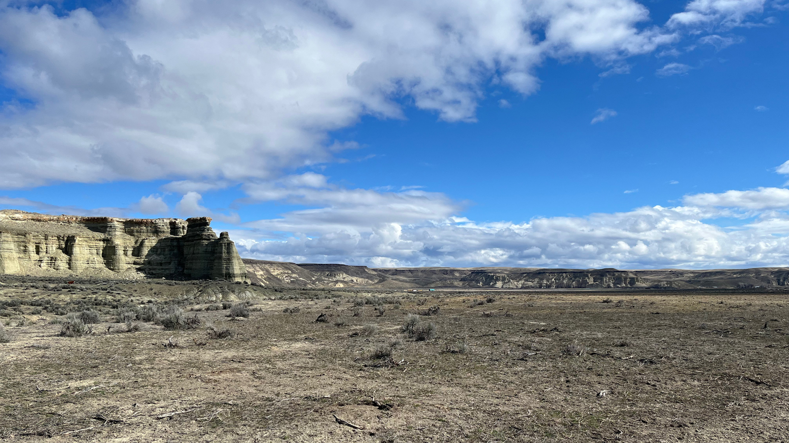
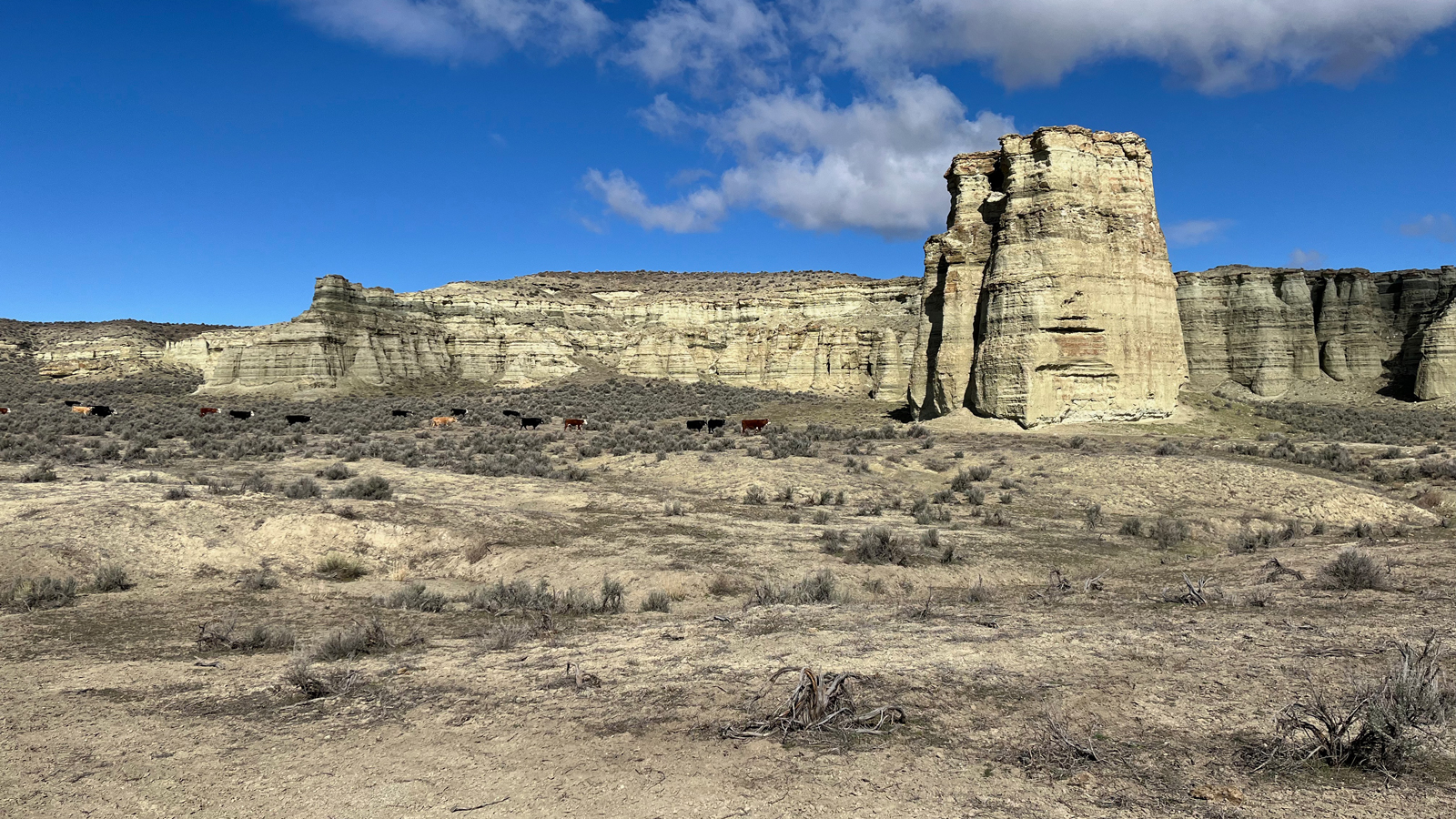
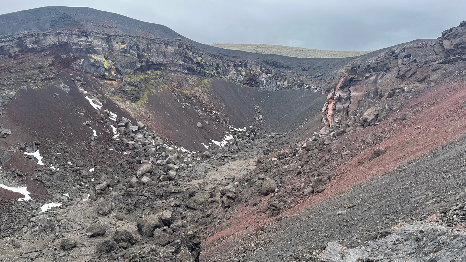
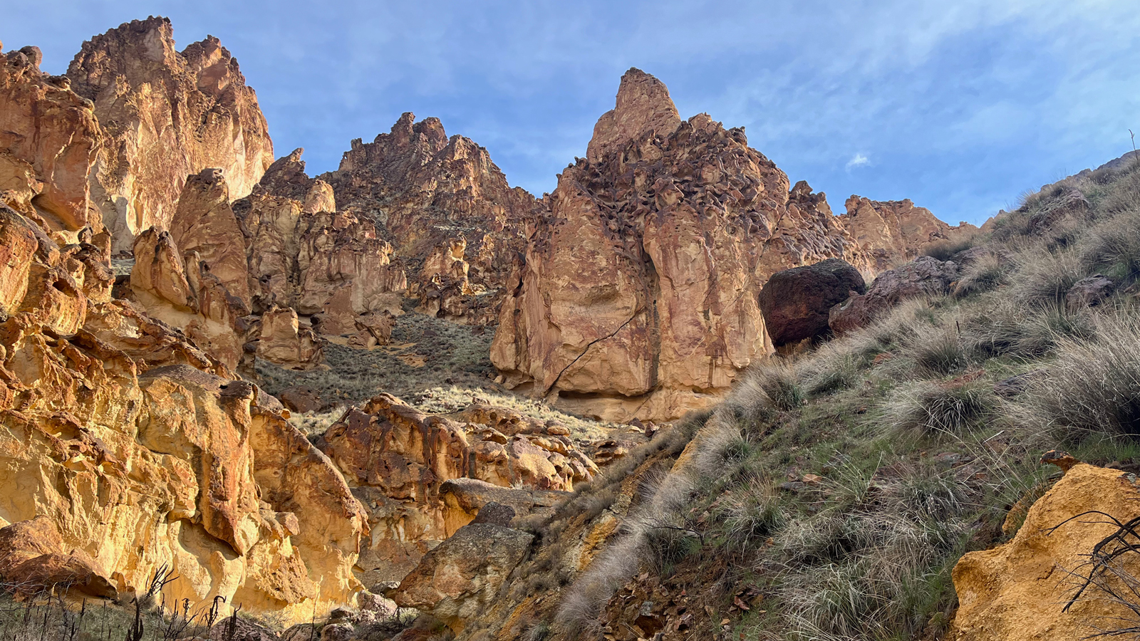
Although we were disappointed that it was still too early in the season to reach Three Forks Recreation Area by car and too far to reach it by foot from Soldier Creek, we were excited to explore more around Rome the next day. We started with the Pillars of Rome, where cows are fenced in around this geological marvel.
The Pillars of Rome stand tall and majestic amidst the rugged beauty of the Owyhee Canyonlands, their weathered spires reaching towards the vast western sky. Carved by millennia of wind and water erosion, these natural formations serve as silent sentinels, bearing witness to the ancient forces that have shaped this remote wilderness.
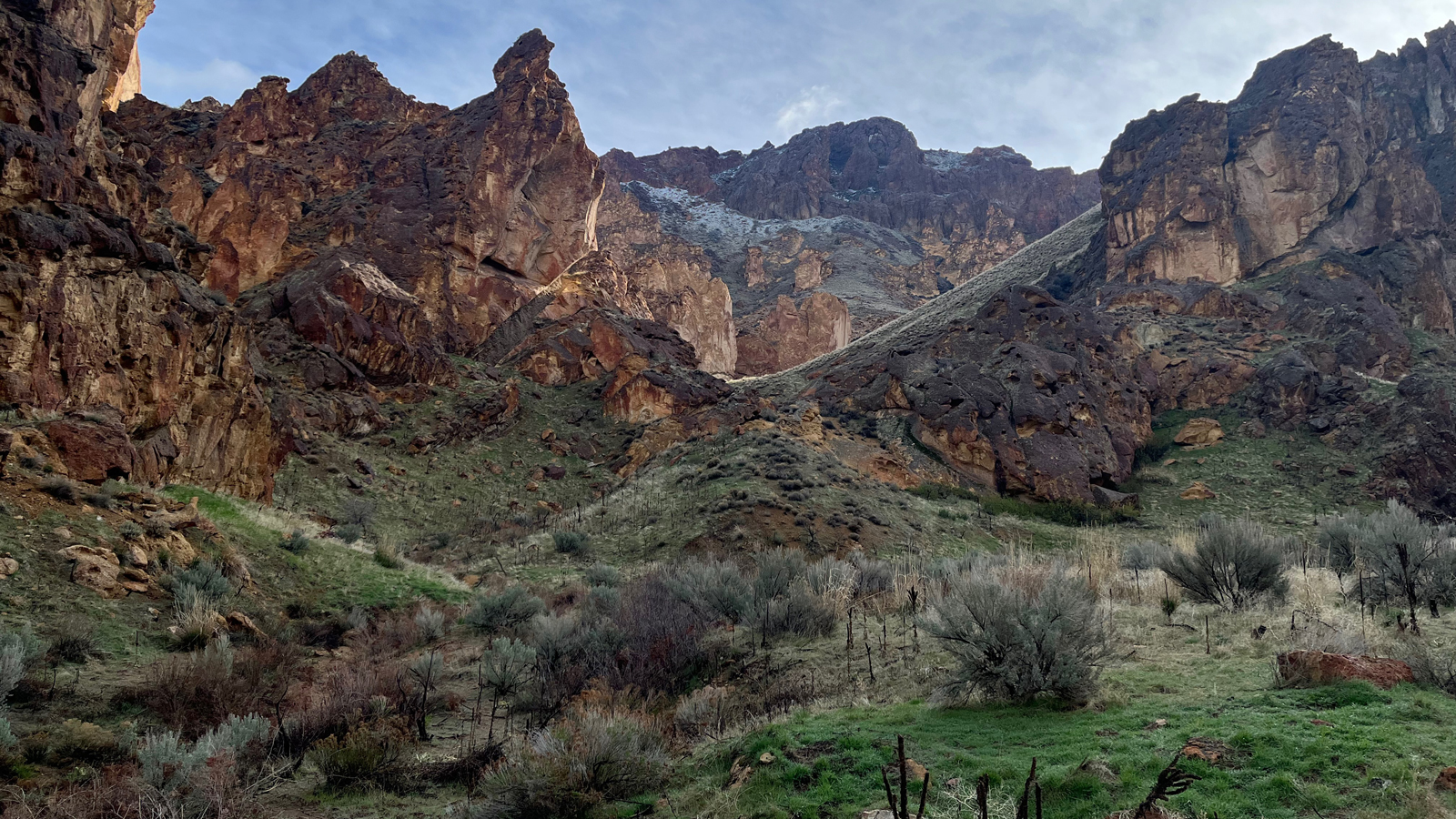
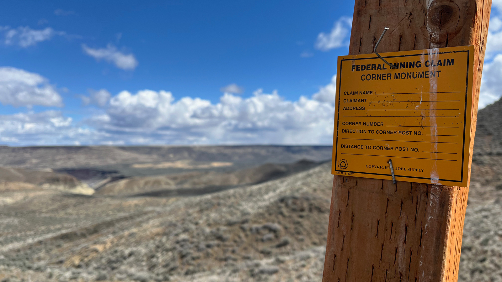
From there, we headed further from Rome to the north to explore Chalk Basin. The drive was rough and slow, but luckily it was fairly dry so we weren’t worried about getting stuck. On our walk, we saw a post demarcating the “corner monument” of a mining claim. For us, seeing this sign highlighted the absurdity of even considering ruining this amazing landscape, which is home to more than 200 species of wildlife, to extract more resources aimed at continuing our society’s pursuit of endless growth.
As we headed back to Rome to find the best path to visit Jordan Craters, we decided to take a detour and follow a brown road sign that said “Owyhee Canyon” with an arrow pointing to a dirt road labeled on our map as Skull Creek Rd. This road was in pretty bad shape the whole way. As the locals would say, it was still too “greasy” to travel safely without high-clearance, 4WD vehicles. We proceeded with caution and after about 3 hours winding through the sagebrush, and seeing a couple of Jeeps that were definitely outfitted for overlanding adventures struggling through the deep mud, we decided to turn back in our Subarus. And just after turning around, we confirmed the need to carry a full-size spare on this kind of adventure when my Dad got a flat tire, which we repaired on the spot before continuing to drive back to the Rome boat launch for a third night.
The next day, we talked to a couple of Bureau of Land Management (BLM) employees as they were headed out on the river. We mentioned the sign that we decided to follow on the previous day and they said they have no idea why that sign is there, since you can’t easily reach the canyon from that side.
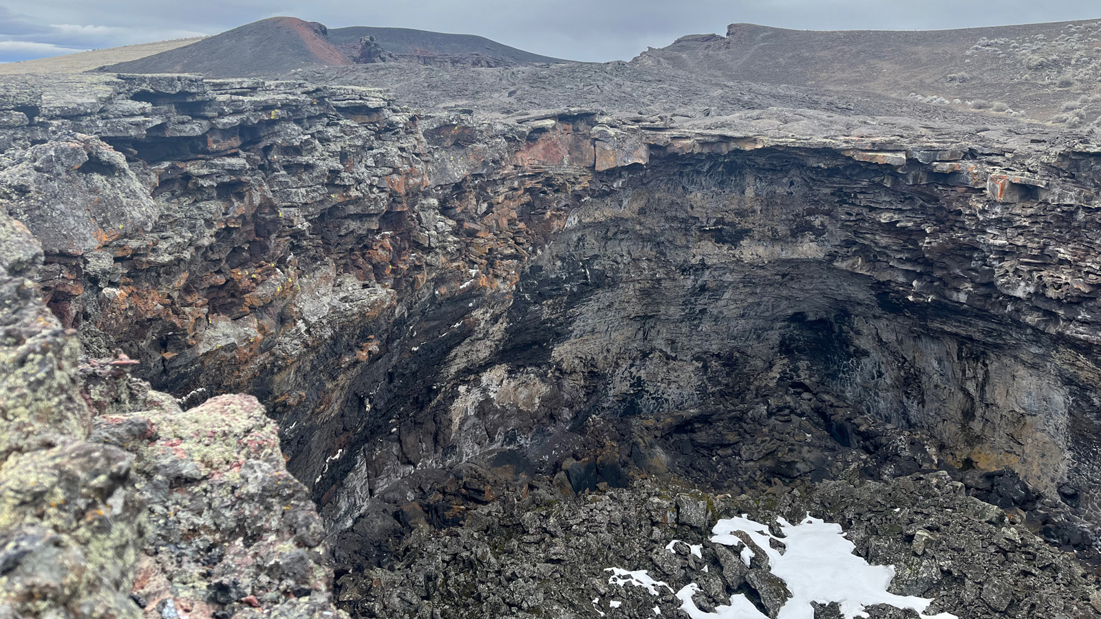
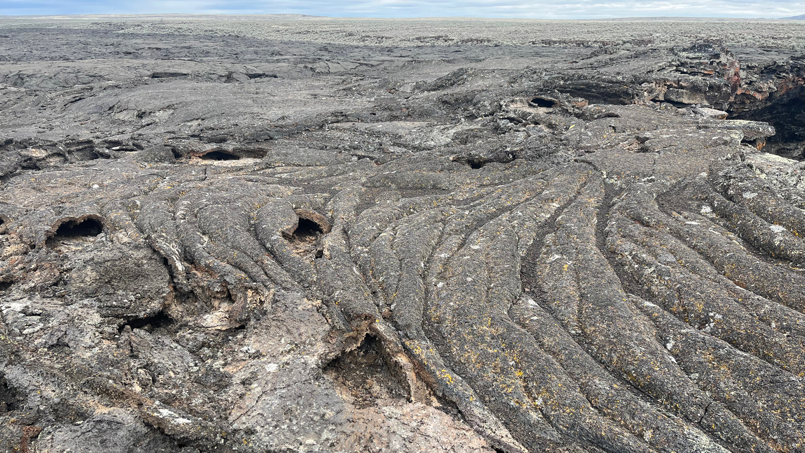
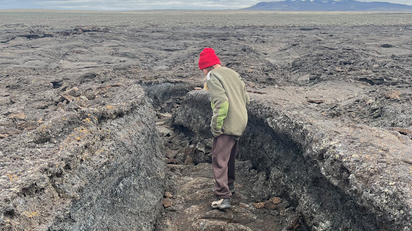
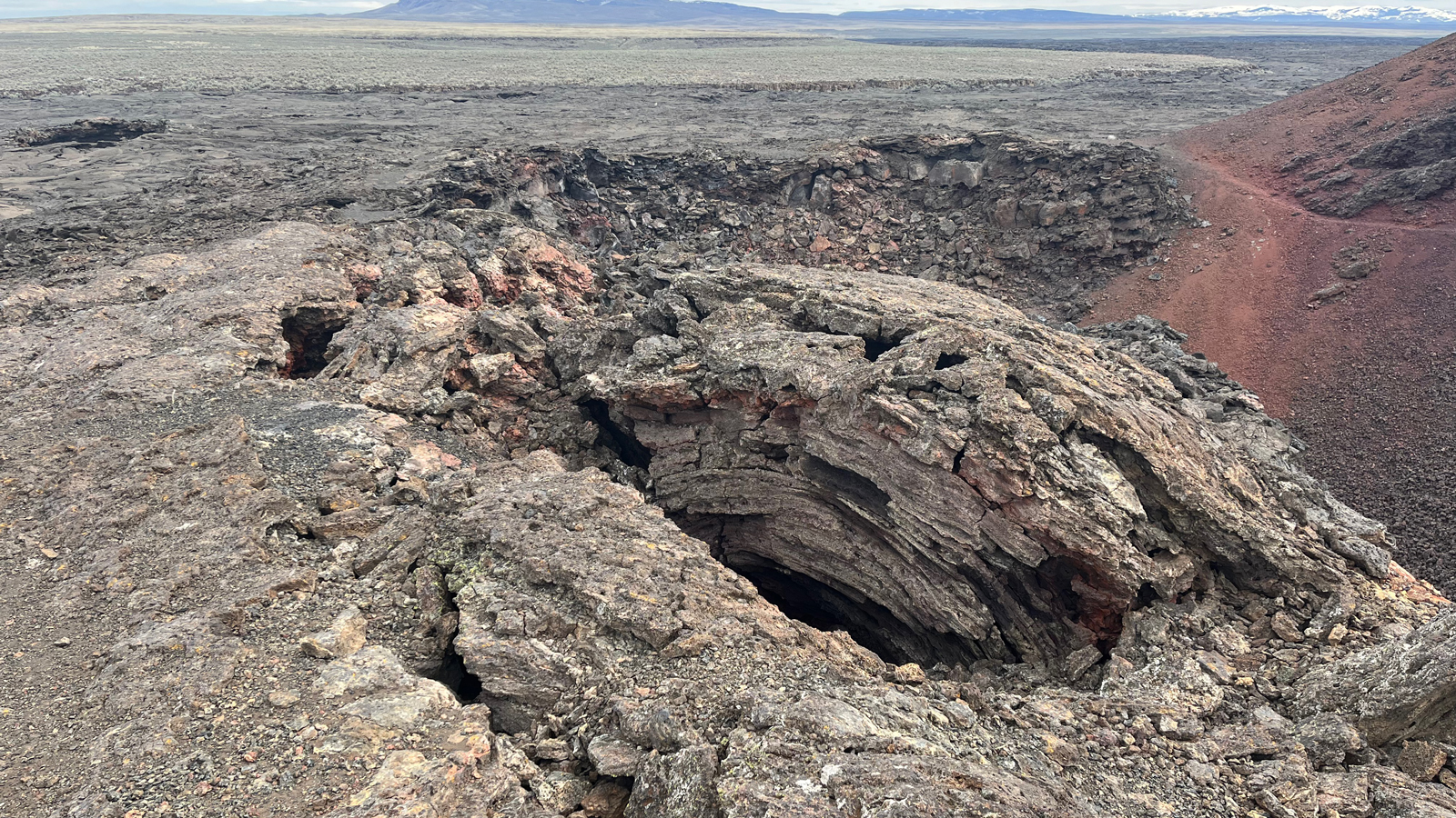
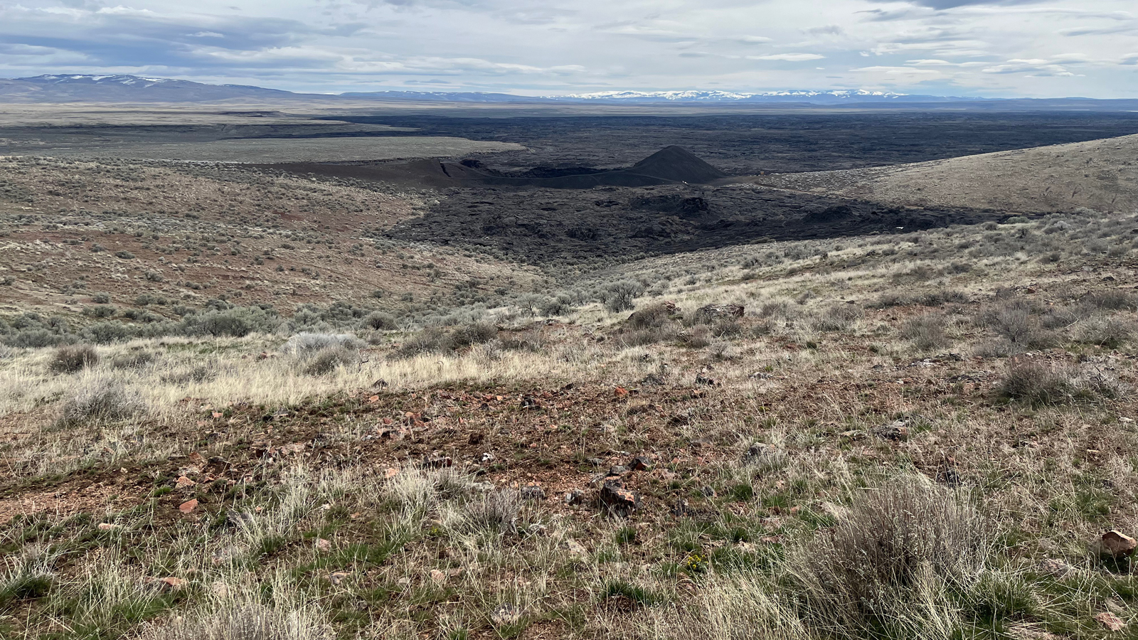
We split up so that my Dad could get a full repair and my daughter and I could continue exploring. We found our way to Jordan Craters, which was truly remarkable. The enormous crater right by the parking area, the easily distinguishable “edge” of the lava flow where the black rock stops and the sagebrush begins, the lava tubes that act as paths from one amazing place to the next. Lava rock that is rippled and layered in a way that clearly reveals its past as liquid. We even saw an owl emerge in flight from one of the giant craters as we approached.
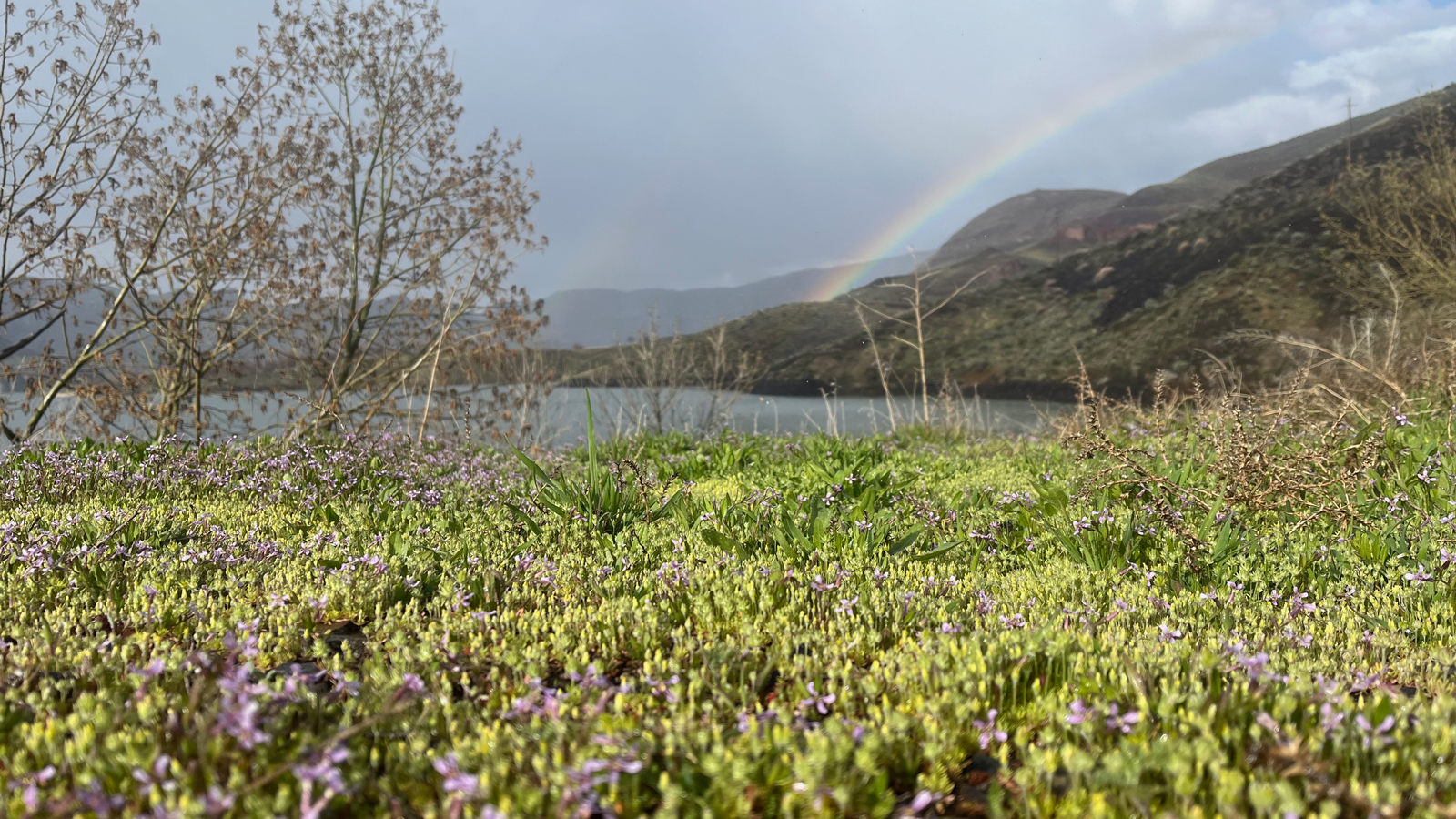
We continued north on our way to Leslie Gulch and Slocum Creek Campground which would serve as a new hub for us for the next couple days. This road was in much better shape and we reached this gulch with little trouble. Here, the intricately eroded red rocks were much more prominent, emerging from a lush green mix of sagebrush and various grasses. We set up camp, my daughter and I walked along the shore of Lake Owyhee, we hiked up a trail in Slocum Gulch, found a trickling waterfall and explored some small slot canyons. A short hike and a wonderful way to get a taste of this completely different part of the Owyhee Canyonlands. We talked with more people at this campground among the dozen sites, meeting people who were also there for the first time and some people that have been coming back regularly ever since they “discovered” it years ago — folks from Idaho, Washington and various places across Oregon.
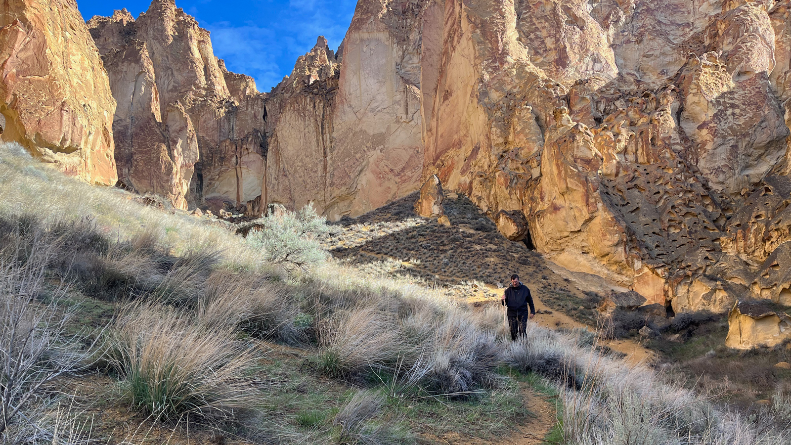
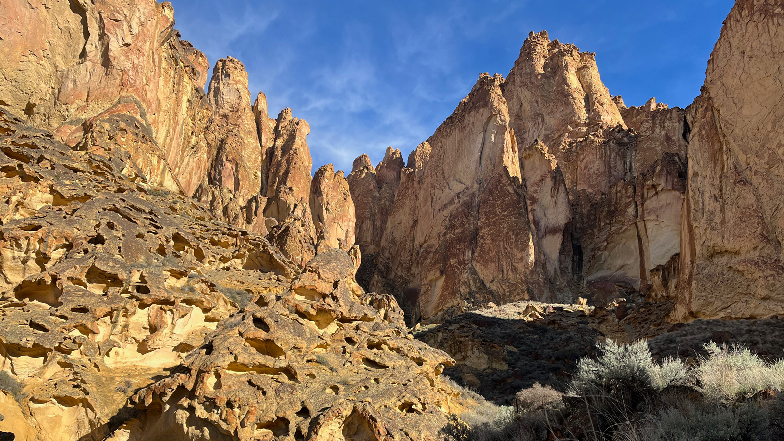
The next day, we traveled just a few miles back up Leslie gulch from the campground to explore the rock formations in Timber and Juniper gulches. Around every turn, there were such cool rock formations. The colorful contrast of the red rock and the green ground, which would be even more stark later in spring, was a visual delight. Thinking about what it might be like to climb up the formations, crawl into some of the tiny caves and even find a little hidey-hole to wrap up in a bivy sack had my imagination running wild.
The hikes in these gulches were a mix of a trail and dry creek beds, with some large rock overhangs and plenty of exquisite honeycomb formations. This was a highlight of the trip and I am looking forward to spending even more time here in the future and making it to the other gulches in the area to see how they compare. Looking back over the hike we did and the whole scene with snow-capped peaks in the distance was a great reward before we headed back to the campsite.
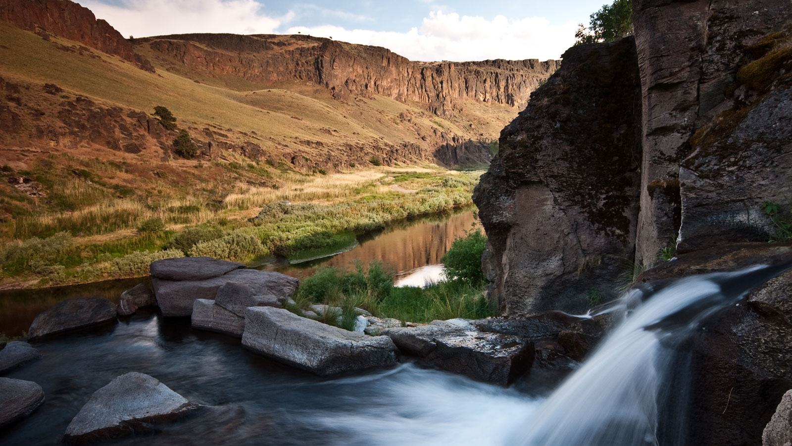
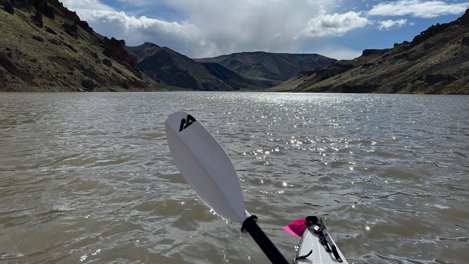
We took advantage of the warmer day to hop in the kayak and adventure by water to a nearby hot spring. It was still cold, and the wind was going to be pushing against us on the way there, so we were bundled up and ready for the upper body workout. My daughter and I shared the paddling responsibilities, switching back and forth so I could take pictures on our journey.
From the boat launch, we set off heading south on the Owyhee Reservoir into the wind. It would be a roughly 4-mile paddle to Echo Rock Hot Spring and the scenery along the way continued to amaze us. Once we arrived, we were greeted by a couple of families that were stopped for the night on their journey rafting down the Owyhee river. They were planning to spend their last night camping near the hot springs before finishing their trip and taking out at Leslie Gulch the following day. They had learned of the Owyhee River a few years prior and have done an annual trip there ever since. It seems that once someone knows about this area, they keep coming back and are even more excited to do what they can to make sure it is protected.
We ended our trip with quick visits to the most established areas within the Owyhee Canyonlands, Succor Creek State Natural Area and Lake Owyhee State Park. There were definitely more people enjoying each of these places than we had seen during the entire trip so far, but they were still far from crowded. There are countless primitive sites throughout the Succor Creek area with plenty of campers and RVs taking advantage. Dozens of people were fly fishing in the creek and Owyhee river below the dam.
At the state park, there were quite a few established campsites with electrical hookups, a couple of basic cabins, and plenty of people camping there with and without boats. We hiked on a couple of trails from Indian Creek campground, which gave us some striking views of the seemingly endless dammed lake despite the overcast day.
My recent expedition through this Oregon marvel left an indelible mark on my soul, igniting a fervent commitment to secure its permanent protection. From the rugged canyons to the tranquil shores of Lake Owyhee, every step reinforced the urgency of our mission.
But the responsibility doesn’t fall solely on the shoulders of a few; it belongs to all who have been touched by the majesty of these lands. We must stand united in our call for action, urging Sens. Wyden and Merkley to work with President Biden to designate the Owyhee Canyonlands National Monument.
Join us in advocating for the preservation of this natural wonder. Together, let’s ensure that this unparalleled landscape remains a sanctuary of wilderness, a testament to the enduring power of nature. The time to act is now.
The Owyhee Canyonlands, one of Oregon's greatest treasures, should be permanently protected to secure its future for generations to come.
Conservation Advocate, Environment Oregon Research & Policy Center
As the Conservation Advocate for Environment Oregon, Justin runs our campaign to Protect Owyhee Canyonlands. Justin has worked on campaigns to protect the Roadless Area Conservation Rule, clean up superfund sites along the Willamette River and promote solar energy in Oregon. In recent years, he was part of the Public Interest Network's Creative and Editorial team where he developed campaign logos and materials connected to dozens of campaigns, turned deep-dive research into digestible interactive features for our websites, and created myriad tools for campaigns to help win real results for the environment and the public interest. Justin lives in Portland with his wife and children where they regularly explore the diversity that Oregon's environment has to offer: From the coast to the high desert and the many amazing rivers, lakes, forests and mountains in between.